How To Create Sketchup Topography

Creating a topographic map can be a huge pain in the neck. If you’ve ever tried to get GIS data or find a city topographic map you know exactly what I mean. In this sketchup tutorial you’ll learn how to create sketchup topography quickly and easily.
How to Create Sketchup Topography
First you’ll need to import your google map into your project.
Make sure that your terrain is toggled on.

Next create a grouped rectangle that covers the entire site. Copy that rectangle up at your desired increment.
Pro Tip: Use an asterisk ‘ * ‘ and a number to multiply that number of copies at the increment you decided.
After you’ve copied all of your rectangles up, group them together.
Move your grouped rectangles off to the side (or hide them) so you can see your imported google earth terrain. Unlock and explode the imported terrain.
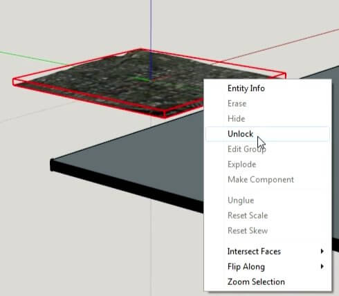
Move your grouped rectangles (slicing planes), over your terrain again (or unhide).
Press Ctrl+A to select all, R-click on one of your groups. Scroll down to Intersect Faces, and select With Selection.
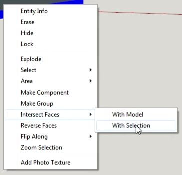
Hide or delete your slicing planes Now you have a topographic map!
If you want to get rid of the faces, right click on one and select ‘all with same material’.
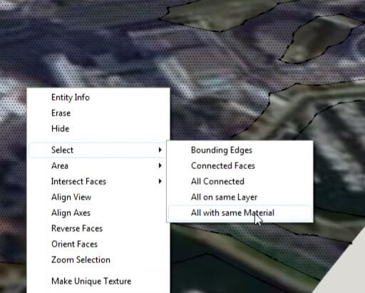
Sketchup will select all of the faces of your topography map. Hit delete and you’re golden!
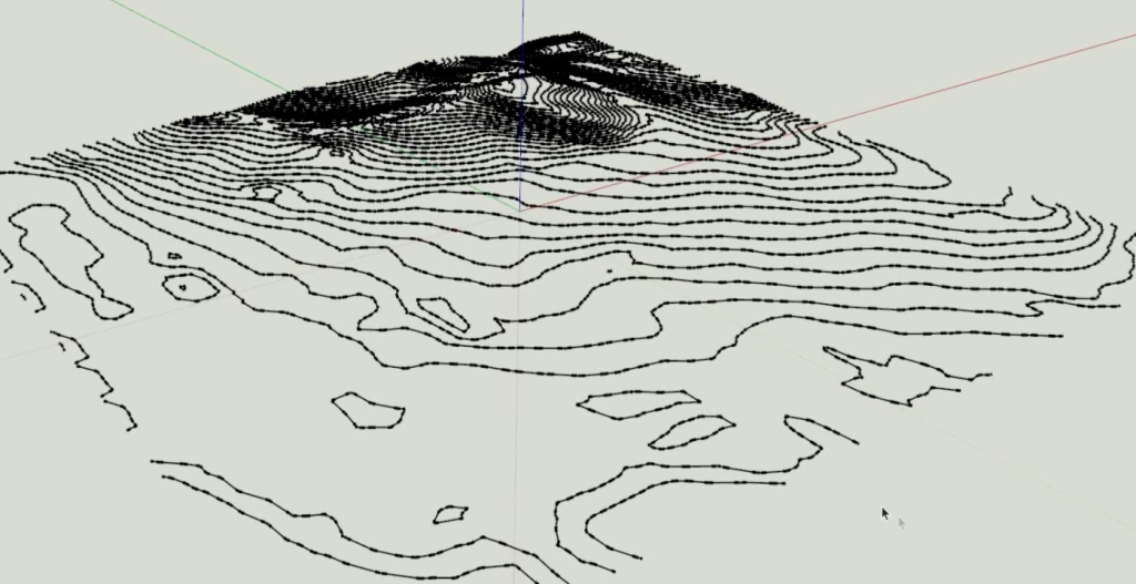
Creating Flat Sketchup Topography
If you’d like to have a flat topographic map, create an additional rectangular surface underneath your lines. This surface should be the same size as your map. I use scale to get it exact.
Move your new surface below the topo line-work.
Select your linework. Use sketchup’s sandbox drape tool. Select your rectangular surface.
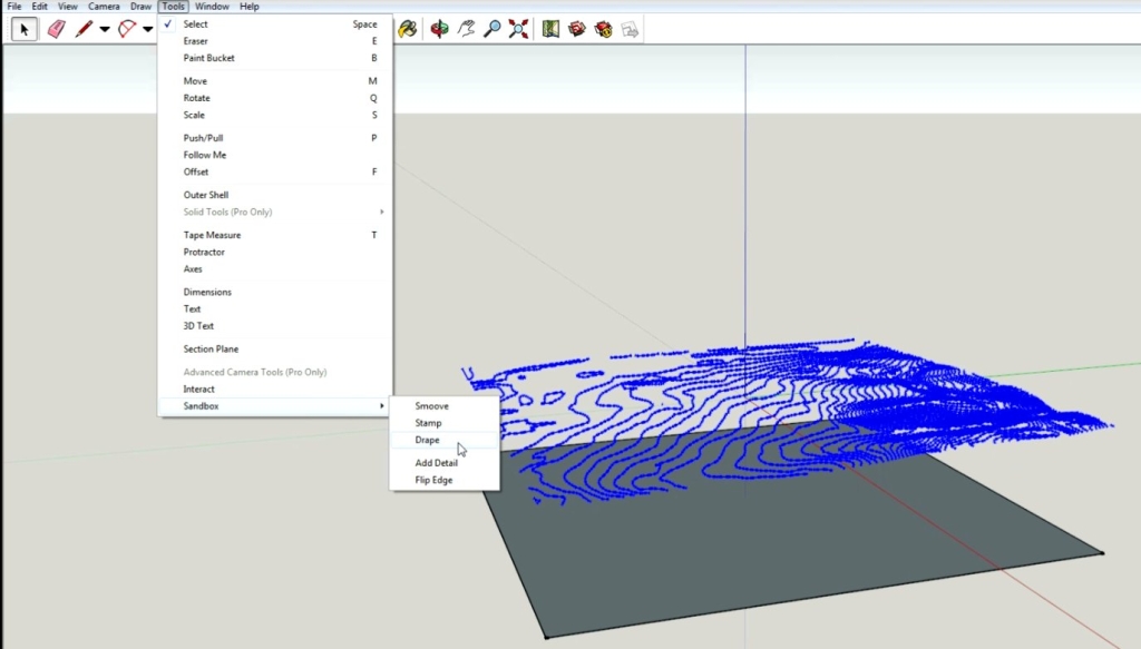
Now you have a 2d topo map!
Did you find this tutorial on sketchup topography helpful? Don’t forget to share it with your friends.

Go to SketchUcation. Get the complete TIG set of plug-ins, but mostly:
Contour Maker V1.6. It makes this easy approach even easier!
Very informative about topography in sketchup.Many surveyors use total station machine to capture surface data.If you please guide us about working with ground surface data used to generate topography in sketchup.Google Earth is applicable for very large area of land while land surveys for narrow pathways are done by total station